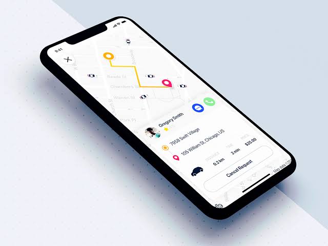
In our digitally-driven world, the ability to pinpoint the geographical location of a device or user has transformed how we interact with web and mobile applications. From finding the nearest coffee shop to tracking the delivery of a package, geolocation services enrich user experiences and operational efficiencies across numerous domains. This blog dives deep into integrating maps and location-based features in full stack development projects, offering a holistic view from database considerations to frontend visualizations and backend logistics.
Understanding Geolocation Services
Geolocation services refer to the technology that enables the identification of a device’s physical location. This can be achieved through various means, including GPS satellites, cell tower triangulation, and Wi-Fi positioning. The most accurate and commonly used method, GPS, relies on a network of satellites to pinpoint a location anywhere on the globe, usually within a few meters.
These capabilities are not just for mapping; they underpin a wide array of applications. Social networks use geolocation to tag posts and photos with places, delivery services optimize routes, travel apps provide real-time guidance, and businesses tailor services to customers based on their location.
Setting the Stage for Full Stack Integration
Integrating geolocation into a full stack project involves several components. The frontend is responsible for presenting location data and maps to users, the backend handles the logic of processing location data, and the database stores this data efficiently for retrieval. Technologies like the Google Maps API for frontend mapping, Node.js or Python for backend services, and MongoDB or PostgreSQL with PostGIS for geospatial databases are commonly used.
Frontend Integration: Maps and User Interface
Embedding a map into your application enhances user engagement by providing a visual representation of data. For instance, using the Google Maps API with a React frontend can be accomplished with the following steps:
Setting up: First, ensure you have a Google Maps API key by registering your application in the Google Cloud Platform console.
Installation: Use @react-google-maps/api, a lightweight wrapper around the raw Google Maps JavaScript API, for easier integration with React apps.
Implementation: Embed a map into a React component as follows:
javascript
import React from ‘react’;
import { GoogleMap, LoadScript } from ‘@react-google-maps/api’;
const containerStyle = {
width: ‘400px’,
height: ‘400px’
};
const center = {
lat: -3.745,
lng: -38.523
};
const MyMapComponent = () => {
return (
<LoadScript
googleMapsApiKey=”YOUR_API_KEY_HERE”
>
<GoogleMap
mapContainerStyle={containerStyle}
center={center}
zoom={10}
>
{/* Additional components like markers can be added here */}
</GoogleMap>
</LoadScript>
);
}
export default MyMapComponent;
This code example demonstrates embedding a basic map into a web application, showcasing the ease with which developers can bring maps into the user interface. The LoadScript component loads the Google Maps library, and GoogleMap renders the map, centered at the specified latitude and longitude.
Backend Integration: Managing Location Data
The backend serves as the backbone for processing and managing geolocation data. For example, consider creating a RESTful API with Node.js and Express to handle location-based requests:
javascript
const express = require(‘express’);
const app = express();
const PORT = 3000;
app.get(‘/location’, (req, res) => {
const { lat, lng } = req.query;
// Imagine this function queries a database or performs some logic to find nearby points of interest
findNearbyPlaces(lat, lng).then((places) => {
res.json(places);
}).catch((error) => {
console.error(error);
res.status(500).send(‘Server error’);
});
});
app.listen(PORT, () => {
console.log(`Server is running on port ${PORT}`);
});
In this example, an endpoint /location is set up to receive GET requests with latitude and longitude as query parameters. It could, for instance, find nearby places of interest by querying a database or an external service. This simplistic example underscores the backend’s role in handling geolocation data to support the application’s functionality.
Database Considerations: Storing and Querying Location Data
Storing and efficiently querying geolocation data requires a database capable of spatial data management. PostgreSQL with the PostGIS extension is a powerful choice for relational databases, enabling complex geospatial queries.
Consider the following SQL example, which finds places within 5 kilometers of a given point:
sql
SELECT name, ST_AsText(location) as location
FROM places
WHERE ST_DWithin(
location,
ST_MakePoint(-122.423246, 37.779388)::geography,
5000
);
This query utilizes PostGIS functions: ST_DWithin to filter places within a certain distance (5,000 meters) and ST_MakePoint to create a point from the given longitude and latitude. The ::geography cast converts the point into geographic coordinates, which are necessary for distance calculations on the earth’s surface.
Advanced Features and Considerations
Beyond basic map embedding and location queries, geolocation services can be extended to include advanced features like geofencing, which triggers actions based on geographic boundaries, and real-time tracking, providing up-to-the-minute location updates.
However, developers must navigate challenges, including scaling to accommodate vast amounts of location data and requests, ensuring accurate and timely location information, and addressing privacy concerns. Users’ location data is sensitive, and applications must adhere to strict privacy policies and regulations, such as GDPR in Europe, requiring clear user consent for data collection and processing.
Real-Time Location Tracking and Updates
Implementing real-time location tracking in a full stack application involves several components, including the frontend for displaying live updates, the backend for handling WebSocket connections, and a database for storing session-based location data. Here, we’ll focus on a simplified version of this system using Node.js for the backend and Socket.IO for real-time communication.
Backend Setup with Node.js and Socket.IO
First, we need to set up our Node.js server to handle real-time WebSocket connections with Socket.IO. This library simplifies real-time bidirectional event-based communication, making it an excellent choice for our purpose.
Install Socket.IO: Assuming you have Node.js and npm installed, run npm install socket.io to add Socket.IO to your project.
Server Setup: Integrate Socket.IO with an Express server to handle WebSocket connections.
javascript
const express = require(‘express’);
const http = require(‘http’);
const socketIo = require(‘socket.io’);
const app = express();
const server = http.createServer(app);
const io = socketIo(server);
io.on(‘connection’, (socket) => {
console.log(‘New client connected’);
// Handle location update events from clients
socket.on(‘updateLocation’, (locationData) => {
// Broadcast the updated location to all connected clients
socket.broadcast.emit(‘locationChanged’, locationData);
});
socket.on(‘disconnect’, () => {
console.log(‘Client disconnected’);
});
});
const PORT = process.env.PORT || 3000;
server.listen(PORT, () => console.log(`Server running on port ${PORT}`));
This server listens for updateLocation events from connected clients, which contain their location data. It then broadcasts this data to all other connected clients using socket.broadcast.emit, enabling real-time tracking of multiple users.
Frontend Integration with Maps
On the frontend, you can use any web framework compatible with Socket.IO to listen for location updates and visualize them on a map. Here’s how you might do it in a React application:
Install Socket.IO Client: Use npm or yarn to add the Socket.IO client library to your project. Run npm install socket.io-client.
Connect to the WebSocket Server: Use the Socket.IO client to connect to your WebSocket server and listen for location updates.
javascript
import React, { useEffect, useState } from ‘react’;
import socketIOClient from ‘socket.io-client’;
import { GoogleMap, LoadScript, Marker } from ‘@react-google-maps/api’;
const ENDPOINT = “http://127.0.0.1:3000”; // Your server URL
const containerStyle = { width: ‘100%’, height: ‘400px’ };
const center = { lat: 0, lng: 0 }; // Initial map center
const MapComponent = () => {
const [location, setLocation] = useState(center);
useEffect(() => {
const socket = socketIOClient(ENDPOINT);
socket.on(‘locationChanged’, (locationData) => {
setLocation({ lat: locationData.lat, lng: locationData.lng });
});
return () => socket.disconnect();
}, []);
return (
<LoadScript googleMapsApiKey=”YOUR_API_KEY”>
<GoogleMap mapContainerStyle={containerStyle} center={location} zoom={15}>
<Marker position={location} />
</GoogleMap>
</LoadScript>
);
};
export default MapComponent;
This React component listens for locationChanged events from the server and updates the map’s marker to reflect the new location in real-time.
Conclusion
Integrating geolocation services into full stack development unlocks a myriad of possibilities for creating interactive, engaging, and useful applications. Whether it’s through enhancing user experience with embedded maps, optimizing backend processes with location-based data handling, or ensuring efficient data management with specialized databases, the tools and techniques discussed herein provide a foundation for developers to innovate and create.
As the digital landscape evolves, so too will the capabilities and applications of geolocation services. Developers are encouraged to explore the vast potential of these technologies, keeping in mind the importance of ethical considerations and user privacy.


Add comment